Informed Wake boating
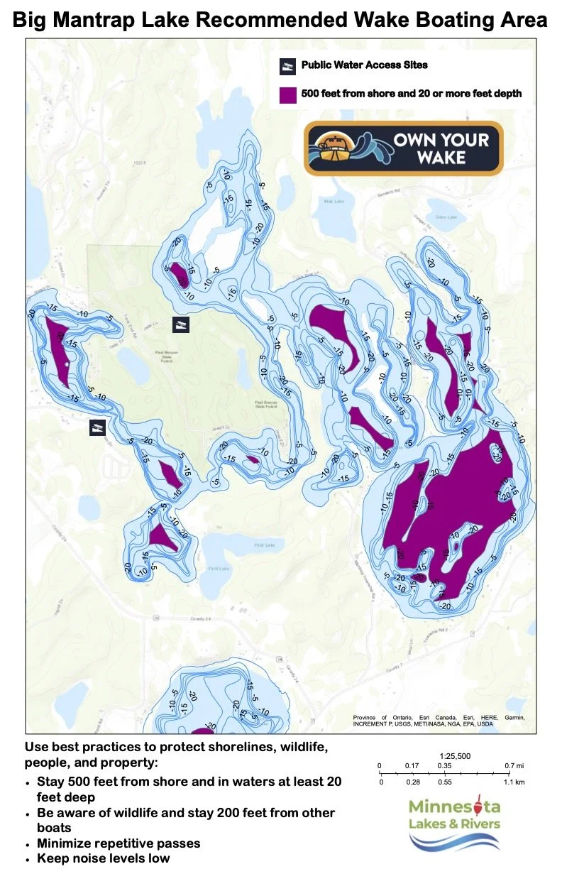
A new custom map is available to help boaters make informed decisions about where to use wake boats on Big Mantrap Lake.
Produced by Minnesota Lakes and Rivers, the map identifies in purple the areas where enhanced wake activities, such as wake surfing, are recommended to occur. Meeting the criteria ‒ being at least 500 feet from shore and in water deeper than 20 feet ‒ helps mitigate the erosion effects of wake boats. The Big Mantrap Lake Association joined this organization last fall, and the custom map is one of the member benefits.
Big Mantrap Lake has an average depth of around 17 feet. About 46% of our lake is a littoral zone at 15 feet or less, so finding the right area to use wake boats can be challenging. This new map should help steer folks in the right direction for fun on the lake.
Staying in the purple areas shown on the map while wake boating can help minimize the impact of large waves, reducing shoreline erosion and decreasing new sediment in the water column, which helps maintain water quality.